
Finding People Along a Payson Street
A useful Payson street search moves from a physical address to records with different roles. First locate the parcel in Utah County Land Records or the Parcel Map. Next compare the assessor owner index with the recorded instrument, then use the voter self-lookup only for a person checking their own status. Historical directories can show a dated household association, but they do not turn an old listing into proof of continuous residence.
Keep the chain in this order: address → parcel serial → owner or indexed party → deed and legal description → permitted building work → voter or directory context. Stop when the question is answered. A street directory is strongest when each name is tied to a date, source, and address field rather than copied into an unlabeled roster.
- Run the complete address through the Utah County address search. Choose Payson in City/Location, then repeat with a missing direction or shortened street type if the first search fails.
- Open the same location in the Utah County Parcel Map. Copy the serial, situs, and legal-location clues before opening nearby polygons.
- Use the Utah voter lookup for the requester’s own registration status. It is not a public street-roster tool.
- Take the serial or legal description to the Recorder’s document, abstract, party, or recording search. Log the entry number, instrument type, parties, and recording date.
- For an older household, compare a directory year, census schedule, newspaper, cemetery entry, or FamilySearch image, while keeping title and residence as separate findings.
Normalize a Payson Address First
Payson addresses can use city labels, county numbering, a plat and block, or an older street name. The General Plan and zoning material place Utah Avenue at 100 N, show 900 N alongside 9600 S, relate 700 N to Arrowhead Trail, and identify 200 S as 10400 S. Main Street and numbered streets also appear in the city grid. These are search terms, not interchangeable proof that two records describe the same parcel.
Write down the modern address exactly as supplied, then test the alternate grid label in the county map and Recorder index. If the address sits near a city edge, check the incorporated parcel and annexation material. Haskellville is described as unincorporated Utah County between Salem and Payson, so a nearby Payson mailing label does not settle municipal jurisdiction. A 2025 Clearwing notice near 3751 W 9600 S and earlier annexation entries show why a date and legal description matter.
Use the situs address for the physical place. Keep a separate field for the tax mailing address, which may belong to a person, lender, trust, company, or an out-of-area location.
Payson Assessor Fields by Address
The Utah County Assessor real-property route sends a street search into the county’s legacy Land Records forms. The address form is built for parcel discovery, not a modern people roster. Its visible fields let the researcher narrow the place before checking owner and tax information.
| Field | Control and use |
|---|---|
| Number | Optional text, with 100 shown as an example. |
| Direction | Optional dropdown for a directional part of the street. |
| Street | Optional text for the named road. |
| Street Type | Optional dropdown for a suffix such as a road type. |
| City/Location | Optional dropdown where Payson can be selected. |
| Record mode | All Records or Current Records Only radio choices. |
The form shows unlabeled search and reset inputs, no ZIP field, and no posted export or result-cap control. A strict search is a good first pass. Removing the direction or changing the street-type wording is a sensible second pass for older indexing.
The captured Utah County assessor view shows the county path that leads into parcel and owner searches, so it is useful before switching to a precise address query.
Open the Utah County assessor real-property route before the image below to confirm the current portal path.
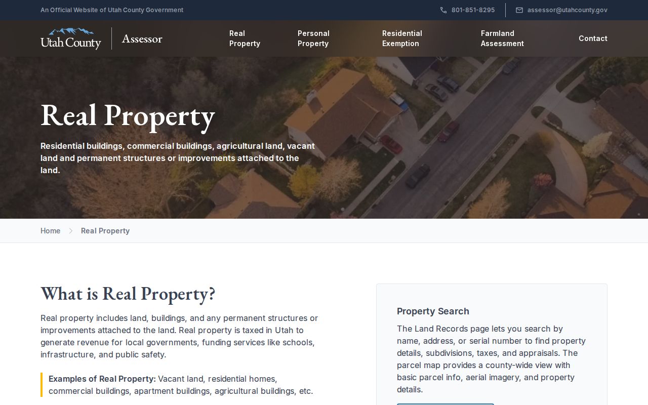
The assessor view is a starting point for a parcel record. Confirm the result with the county map and Recorder before describing a person as connected to the street.
Place Each Payson Parcel in GIS
The Utah County Parcel Map adds the geography that a name or address index lacks. Search by address/common place, serial or book/page, owner, PLSS section/township/range, or city. The address autocomplete accepts abbreviations, suffixes, and directional forms. An owner search may be partial or full but can be slow, so a returned name should be selected before using Zoom to.
Turn on parcel and road layers as needed. The map also offers basemap choices, a legend and transparency control, measurement tools, deed-point links, and PDF, print, and export controls. City selection can move the view to Payson, while PLSS can help when an early legal description does not match a current street string.
The map’s historic-date control has a narrow meaning. Its date tells when an entry entered the online property system, not necessarily when a deed was recorded. Treat the viewer as reference material, then use the Recorder’s official index for the legal event.
Use the map to establish location and geometry. It does not prove that every person near the polygon lives there, and its disclaimer means it is not a survey.
Payson Records Searchable by Street
The address record chain has several layers. Each one can answer a street question, but none is a complete list of people along a road. The coverage below keeps owner, location, residence, building work, and historical household evidence distinct.
| Record Set | Keeper | What It Shows | Access |
|---|---|---|---|
| Property / tax roll | Utah County Assessor | Owner, tax mailing address, parcel and valuation clues | Free portal |
| GIS parcel map | Utah County GIS | Situs geometry, serial, city selection, layers | Free viewer |
| Deeds and liens | Utah County Recorder | Recorded parties, instrument, legal description, prior entry | Free index, paid copies |
| Voter records | Utah election offices | Self-status or controlled election-data fields | Rules, fees, and limits apply |
| Building permits | Payson Development Services | Project address, inspections, approval history | Current online route, older files by request |
| Directories / Sanborn | Utah collections | Dated household or building context | Library, archives, or digitized access |
The parcel serial is the strongest bridge between the current map, assessor record, deed index, and permit file. A street name helps you browse, but a legal description or serial is safer when a road has alternate labels. Voter information is a separate election record. It should not be used to publish a street roster.
Search Payson Serial and Entry Numbers
When an address is inconsistent, search the identifier instead. The county property form accepts serial examples such as 411750010, 41:175:10, and 41 175 10. It can show the life of the property or a selected tax year. The abstract form uses shorter and punctuated versions, including 4117510, 41:175:10, and 41 175 10. The serial and entry form accepts a serial or entry number with a year.
Test the short, colon, space, and hyphen styles where the portal allows them. Follow the legal description, parent parcel, subdivision, plat, tie, and release references. Search the document-type and KOI form when the instrument category matters, and use the recordings search for an entry/year or date range.
The first image below shows how the Utah County property form supports a tax-year comparison.
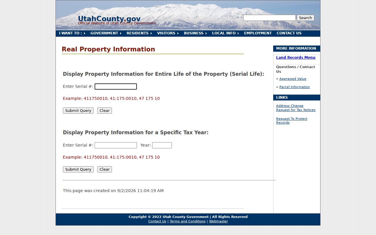
The property form is useful for comparing a current record with an earlier tax year, but it remains an assessor path rather than a title opinion.
For a known entry, the image below shows the alternate Utah County serial-entry route from identifier to document result.
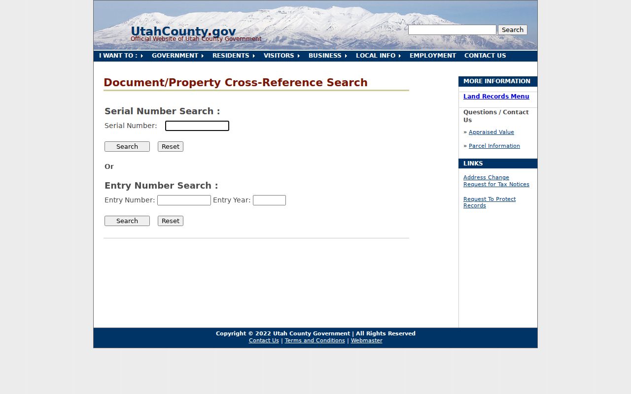
Keep the exact serial or entry number in your notes. It is more durable than a copied name or an address with a changed suffix.
The image below shows the Utah County abstract search, which adds a legal-description route when a street search is too loose. Compare its serial format with the property result before following an older entry.
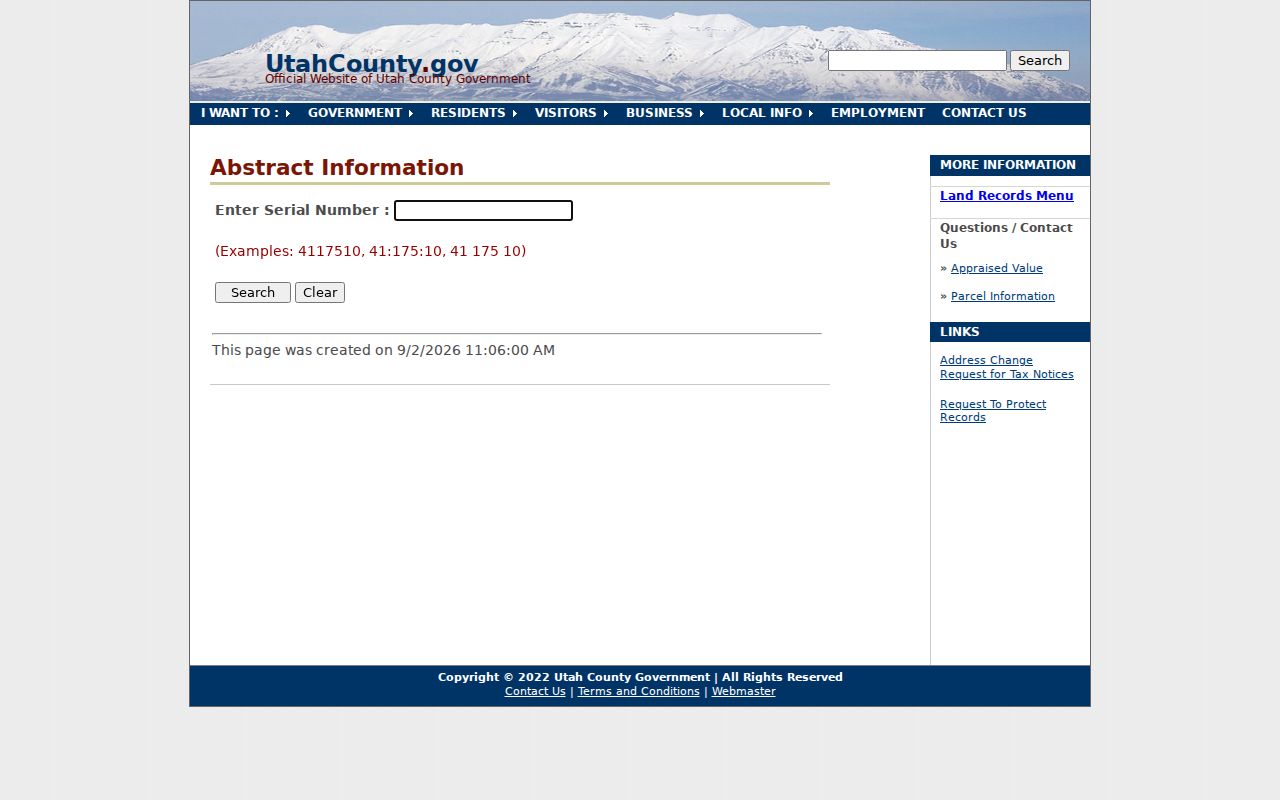
An abstract result can point toward the parcel’s recorded history, but an official copy and legal interpretation belong with the County Recorder.
Separate Owner Names From Residents
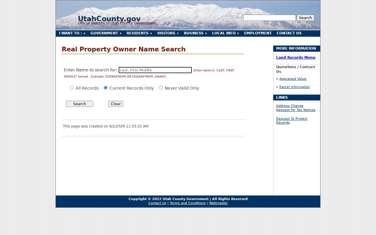
The Utah County owner-name search uses Last, First Middle formatting. It offers All Records, Current Records Only, and Never Valid Only modes. A result can point to an assessment identity, not the person who occupies the parcel. Trusts, lenders, companies, and out-of-area owners are common reasons the name and street do not line up.
Use the name result to find a serial, then return to the property and Recorder paths. Compare the party role, tax mailing field, situs, recording date, and legal description. Do not treat a lender, release, trustee, or incorrect tie as a household member. The captured owner-name search illustrates the name format and record-mode choices.
A clean match still needs a second source. A deed identifies parties to an instrument, while a historic directory or census identifies a dated household clue.
Follow the Payson Deed Chain
The Recorder’s public explanation describes official records from 1870 forward, with handwritten alphabetical indexes from 1870 through January 1978 and computerized indexing from January 1978 onward. Abstract records overlap the transition, with handwritten or typed material through September 1985 and computerized or online coverage beginning in May 1980. A missing online hit can therefore mean a format or index problem, not a missing deed.
Open the property or abstract result, then log the grantor, grantee, document type, book/page, entry, recording date, affected serial, and every tie or release. The Recorder does not prepare legal documents or perform a public title search. Its office says first recording controls document priority. For an official copy, verify the current fee schedule before ordering. A recorded deed may cover an easement, public road, mortgage, release, or trustee action.
- Situs address
- The physical location of a parcel, distinct from the tax mailing address.
- Parcel
- A mapped unit of land identified by a county serial.
- Plat
- A recorded map that lays out lots, blocks, streets, or other land divisions.
- Criss-cross directory
- An address-based directory that can connect a street and house number to a dated household listing.
Payson Street Roster Limits
The Utah voter self-lookup includes first name, last name, date of birth, street address, city, and ZIP. It is designed for a voter to check registration and polling information. A statewide voter file is a paid, controlled product with permitted-use, timing, disclosure, and At-Risk rules. Full birth dates are restricted. County maps can place Payson addresses in precincts 401 through 414, but a precinct map is geography, not a resident list.
ZIP adds another boundary warning. Payson’s primary ZIP is 84651, which is also associated in the state table with Elk Ridge and Spring Lake. Salem’s nearby postal geography uses 84653. ZIP 84651 does not establish Payson city limits. Validate the delivery address with USPS, then use GIS for the parcel municipality.
Phone and counter help remains available. Utah County Elections is at 100 E Center, Suite 3100, Provo, with 801-851-VOTE (8683). The County Recorder is at 100 E Center, Suite 1300, with 801-851-8179; GIS is reachable at 801-851-8626. A person seeking a specific unposted city or county record can use the Utah County GRAMA form, requesting inspection or copies and authorizing an estimate when required.
What Payson Street Records Cannot Show
A Payson street directory cannot promise every household member or a current occupant. The assessor’s mailing field is not a residence confirmation. A recorded grantee may be a lender, trustee, company, or other instrument party. Historical listings can omit children, short-term occupants, people who declined listing, or anyone who moved after the directory was prepared. DMV address data and utility customer lists are not open substitutes for these gaps.
Use records for a lawful personal purpose such as family history, property history, a seller check, or civic research. For a city record that is not posted, contact the Payson City Recorder at 439 W Utah Ave, 801-465-5205, generally Monday through Thursday 7:30 a.m. to 6 p.m., or use the city GRAMA route. Older material may require the Payson Library, FamilySearch Center, Historical Society, Utah Archives, county counter, mail request, or a records officer’s direction.
Lawful use. Payson street and address records support personal, family-history, property, and civic research. Do not use an address record to stalk, harass, intimidate, or harm anyone.